Camping on the Sentier Nepisiguit Mi’gmaq Trail (SNMT)
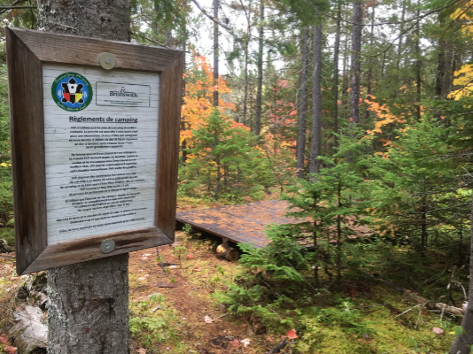
In an effort to protect the natural splendour of the trail, overnight hikers are encouraged to stay at one of the 22 designated campsites. Reasonably flat and drained areas for tenting on the 150 Km long SNMT can be surprisingly difficult to find therefore, knowing campsite locations is also in a hiker’s best interest. Be sure to study this page carefully when planning your trip!
The first campsite after leaving the eastern trailhead at Daly Point Nature Reserve (Km 0) is at the Gitpu (Eagle) Campsite at Km 24. Thereafter, campsites can be found 2 to 15 km apart until the trail’s termination in Mt. Carleton Park (western trailhead – Km 150). All campsites are within sight of the Nepisiguit River and a readily accessible water supply (with the exception of the Popple Depot site which will require a 300 meter walk to the Popple Depot Bridge). Campsite locations can be seen on the Interactive Map. It is highly recommended to purchase and bring with you on your hikes the much more detailed SNMT guidebook and SNMT topographic map (See FAQ #3).
Sites cannot be reserved and operate under a “first come, first serve" basis.
There are three types of campsites. The most popular are those with a shelter. There are eight shelters on the trail spaced between 11 and 28 km apart. When the shelters are crowded or for those who just want to tent, three of the shelters have platforms (elevated wooden decks, typically 3 or 4) erected nearby. Each platform can accommodate a single or double tent. The remaining five shelters have “primitive” tent sites, essentially cleared areas for at least two tents (single or double tents). Each shelter campsite has an outhouse.
.png)
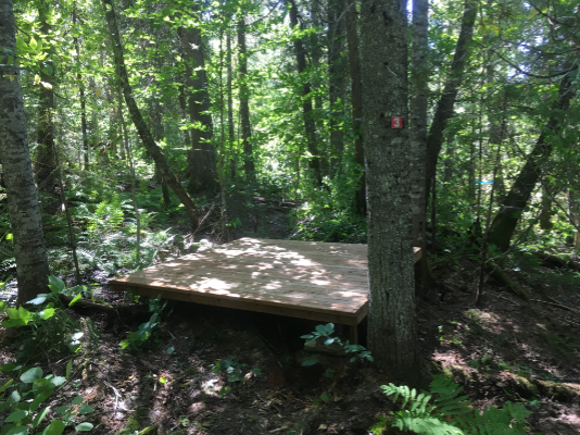
The second type of campsite has platforms only. There are three such campsites and each can accommodate three single or double tents. There are no outhouse facilities at these campsites.
The third type of campsite has primitive campsites only. There are eleven such campsites and they can be in a small clearing or merely a widening in the trail and can accommodate between two and four single or double tents. There are no outhouse facilities at the primitive campsites.
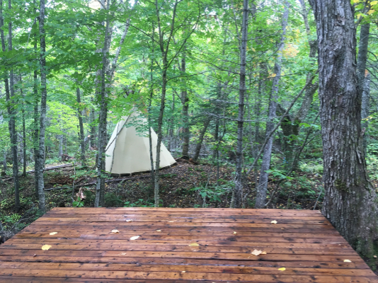
A few sites have teepees. These are not fixed structures and are periodically removed for maintenance and repairs. Hikers are invited to visit them but dirt floors and a tendency to leak in wet weather make them unsuitable for overnight accommodations. Their main purpose is to remind visitors of the Mi’gmaq peoples who lived in the Nepisiguit watershed for millennium. In such natural settings, the teepees also offer striking photo opportunities.
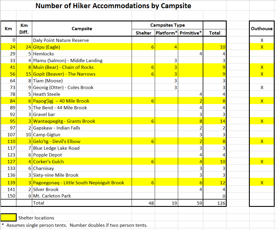
The following table shows all the campsites, their types, number of hikers accommodated and outhouse placements. Below the table are detailed descriptions of campsites and GPS coordinates.
1. Shelter Sites
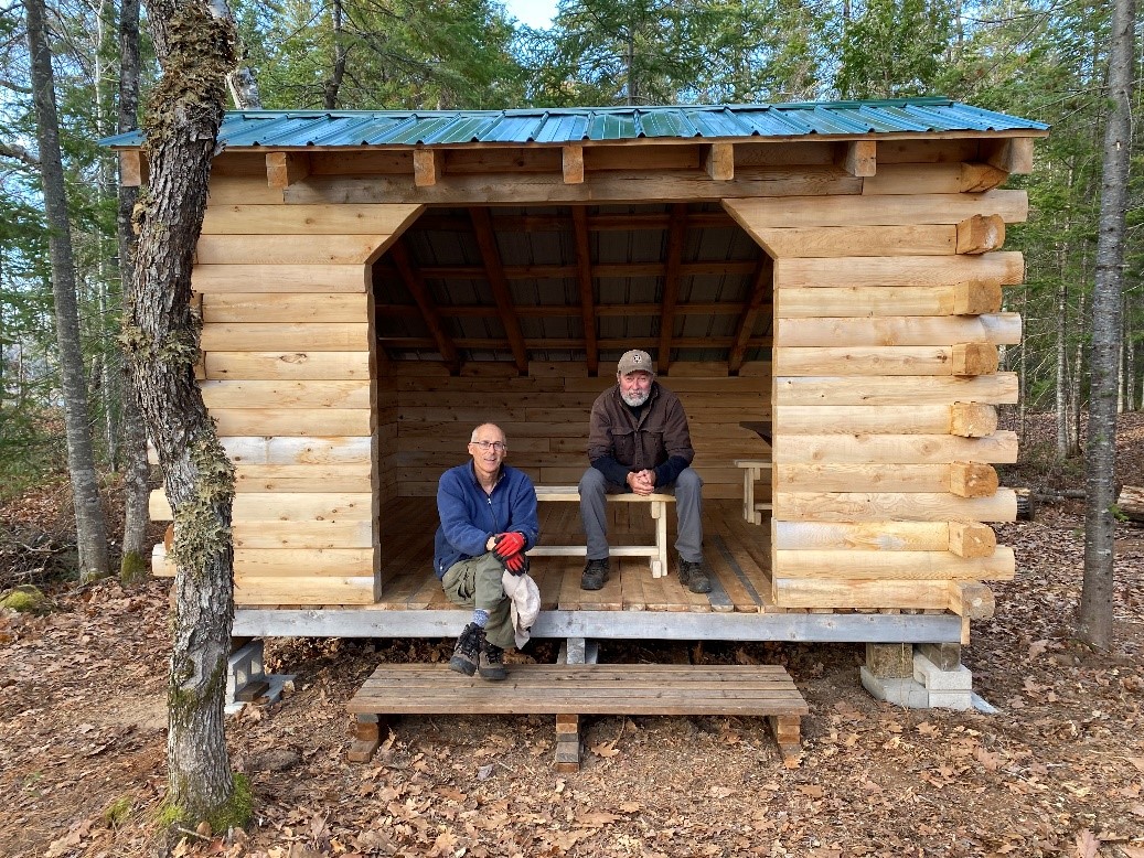
The SNMT has 8 shelters. Built of cedar logs, they resemble a lean-to with one wall open to the elements. Each shelter can lodge 6 hikers who lay out their pads and sleeping bags on the floor. Shelters are equipped with a folding table, three benches, wall hooks and a broom.
SHELTER ETIQUETTE
1. The shelters are very popular especially in bad weather. Try to accommodate everyone and be considerate when spreading out your gear.
2. Leave behind no food or garbage. It is unpleasant for future hikers and attracts unwanted wildlife. Leave No Trace!
3. The shelters are for the sole use of registered hikers on the SNMT who normally use the shelter for one night and move on. Extended stays in the shelters are not permitted.
4. Open fires are not permitted on the SNMT. It is recommended that food be cooked with a portable jet stove or similar device.
5. Sweep clean the shelter before departing. The small gest will be appreciated by all!
6. Please no graffiti. Volunteers have made a great effort to erect these shelters. Try to keep them as pristine as possible.
Descriptions of the eight shelter sites:
.png)
Gitpu (Eagle) - Km 24
A shelter, teepee and four platforms.
Gitpu is located roughly 2 km upriver from Pabineau Falls on Section C-D. The site is dominated by a large pink granite "shelf" jutting into the river. A perfect spot to prepare a meal or relax after a day on the trail. Facing the river, if you look to the right, you will see Gitpu Menigu (Eagle Island) where a large bald eagle nest can be seen in a giant white pine at the tip of the island.
.png)
Muin (Bear)- Chain of Rocks - Km 41
A shelter and three platforms.
Muin is located at the Chain of Rocks, named after a challenging stretch of rapids. Many day hikers trek in 8 km from an SNMT parking lot at Access E (Highway 360) to see the waters of the Nepisiguit cascading over large boulders and ledges.
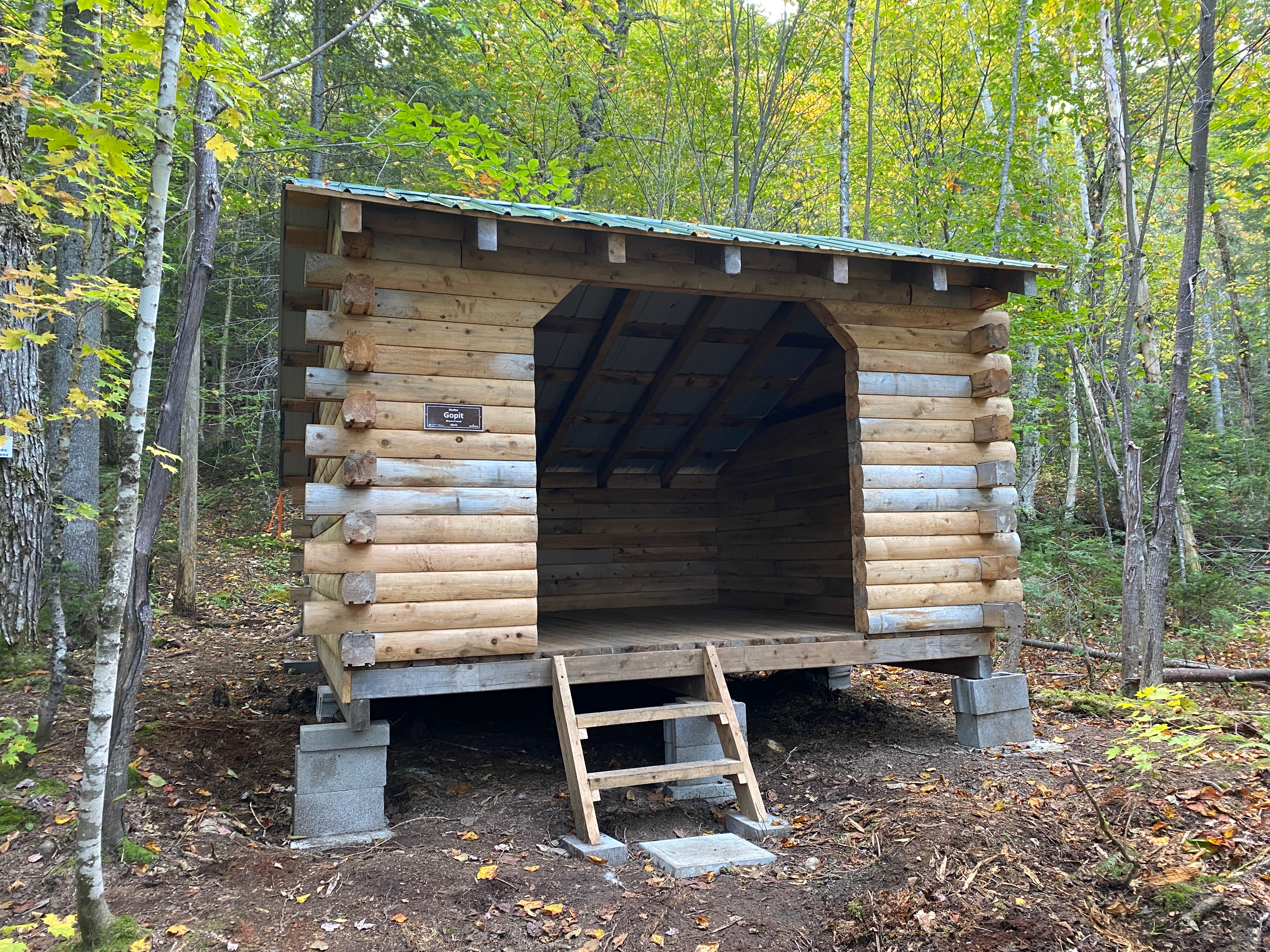
Gopit (Beaver) - The Narrows - Km 56
A shelter and three platforms.
The Gopit shelter is located near Sam's Lookout which gives a spectacular view of the famous steep canyon walls and rushing waters of the Narrows. The site's three platforms are located 100 meters east of the shelter.
.jpg)
Papog’jigj – 40 Mile Brook - Km 84
A shelter and two primitive tent sites.
Papog’jigj (Bah Bohk jeej) means “Little playful waters”. This shelter is built close to the Nepisiguit River with a clear view of the opposite bank where the waters of 40 Mile Brook join.
Wantaqpegitg - Grants Brook- Km 95
A shelter and eight primitive tent sites.
Wantaqpegitg (wan·tahk·pe·gitk) means “flowing calmly”, an accurate description of the Nepisigui River at this point.
.png)
Gelo’tg - Devil’s Elbow- Km 110
A shelter and two primitive tent sites.
Gelo’tg (ge·loodk) means “The watchers of the river” and refers to two large rocks partially blocking the Nepisiguit River's flow slightly upstream of the campsite. These "Gaurdians", according to Mi'gmaq lore, must be given an offering before safe passage can be granted to the upper river valley.
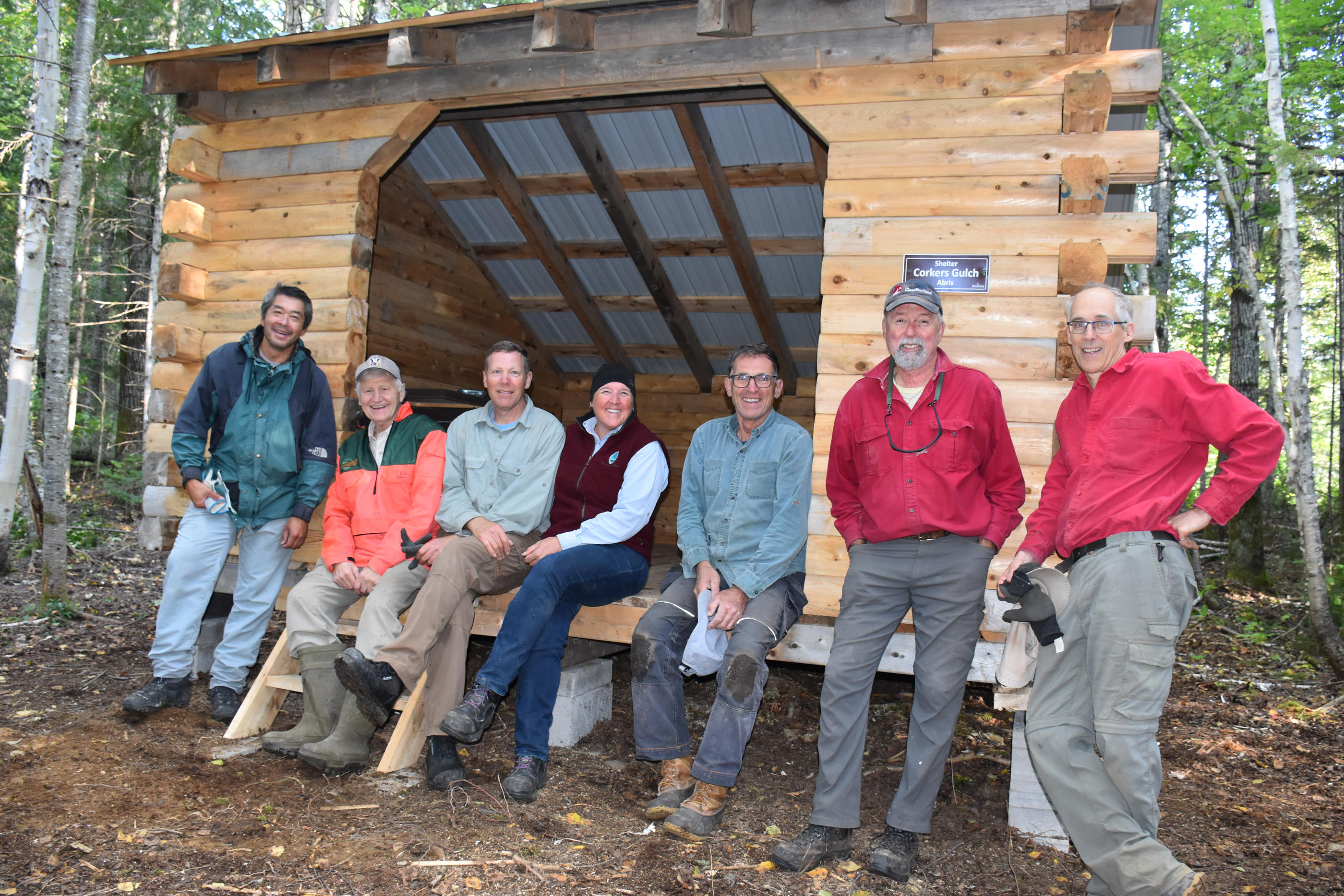
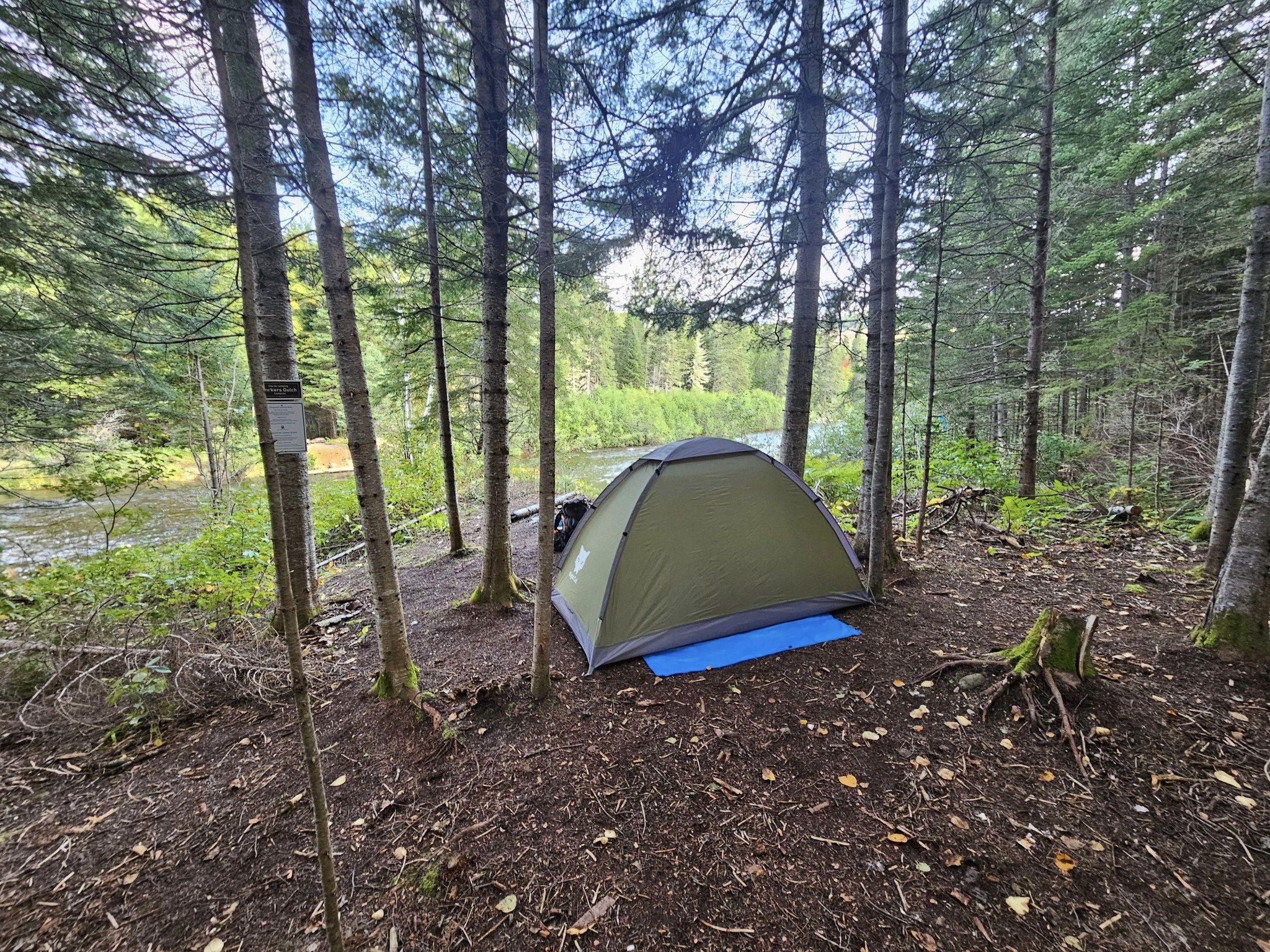
Corkers Gulch - Km 127
A shelter and four primitive tent sites.
This shelter is built in an extended flat area with good sites for tents.
.jpg)
Pagoegonaq - Little South Branch - Km 139
A shelter and six primitive tent sites.
Pagoegonaq (ba-go-egg-go-nawk) means “Where the water gets shallow”. This campsite is on the west side of a rope bridge that crosses the Little South Branch River. Tent sites can be found on either side of the bridge. A number of red oak acorns were planted near the bridge in 2022. Keep an eye out for the young oak trees.
2. Platform Sites.
There are three platform camping sites along the trail. All of them are within the Trail’s Delta Zone (ie. between Km 0 and Km 78). Each site has three platforms that can accommodate a single or double tent (Sorry, larger tents will not fit!).
2. Platform Sites.
There are three platform camping sites along the trail. All of them are within the Trail’s Delta Zone (ie. between Km 0 and Km 78). Each site has three platforms that can accommodate a single or double tent (Sorry, larger tents will not fit!).
Descriptions of the platform sites:
Plamu (Salmon) - Km 33
Three platforms.
Plamu is located less than a 100 meters south of Access E on highway 360 on a massive ridge of rock that forces the Nepisiguit River to make several sharp turns. Downstream of the Highway 360 bridge is a wonderful, deep pool for bathing on hot summer days.
Tiam (Moose) - Km 64
Teepee and three platforms.
Tiam is well named as it is located in an area frequently visited by moose. Its wide open vistas give unobstructed views of the river or night skies. Perfect for savouring a steaming cup of coffee!
Geonig (Otter) - Km 73
Teepee and three platforms.
Geonig is on an enchanting hillside of old pines and mixed hardwoods through which Coles Brook cascades over moss covered rocks.
3. Primitive Camping
Eleven so-called primitive campsites have been developed for single or double tents (Sorry, larger tents cannot be accommodated!). They are marked with a sign but are easily missed especially if hikers are not looking for them or are not following GPS coordinates. The sites could be as simple as a slight widening of the trail. They do however, offer the most natural of settings for those seeking a complete escape from civilization.